This 5-minute guided tour of Photos Workbench rushes you past all the landmarks and leaves you wanting. The tour guide encourages you to download Photos Workbench to satisfy your curiosity.
Tag: Geocode
Add Locations to Photos Using Photos Workbench
Photos Workbench offers several methods of adding locations to photos:
-
- Drag-and-drop photos on a large map
- Automatic geocoding use a track log from a GPS device or iPhone app
- Incremental geocoding places photos along the path you traveled
Location information will allow Apple Photos to show your images on a map. It will help you look up images that you did not otherwise file or tag.
Knowing – and showing – where you took a photo adds to its “story”. On the map in Photos and Photos Workbench you get a bird’s-eye view of where you took your photos and the route you took to get there.
Let’s see Photos Workbench in action.
Introducing: Photos Workbench
Photos Workbench is a companion to Apple Photos on macOS. It helps you organize, name, and compare your photos.
HoudahGeo 6: A New Way of Lining Up Photos with a GPS Track
Automatic geocoding in HoudahGeo matches photos to a GPS track log. A track log is a record of where you have been. A GPS app or track logger records your current position and the current time. It does so every few seconds and thus creates a breadcrumb trail of your travels.
HoudahGeo figures out where you took a photo by matching the timestamp on the photo with the times in the GPS track log. While the GPS device gets accurate time information from satellites, your camera clock is probably not accurate. Most cameras also do not record time zone information: the photo coming out of the camera may say it was taken at 12 PM, but there is no telling if that is to be understood as 12 PM east coast or west coast – a 3-hour difference.
Timestamps in HoudahGeo
HoudahGeo needs to know the exact time a photo was taken. That is why HoudahGeo asks about camera clock settings when you import images.
There are 4 ways you can tell HoudahGeo about your camera clock settings. The first 3 are found in the Load > Camera Setup… panel. This panel pops up automatically when you import photos that lack time zone information.
You can skip Camera Setup… – accept the current settings – and proceed to import more images and GPS track logs. We will correct the camera clock settings later by matching a key photo to a spot on the track log. Continue reading HoudahGeo 6: A New Way of Lining Up Photos with a GPS Track
Working with Apple’s Aperture on macOS Catalina and Big Sur
In June 2014, Apple announced that the development of Aperture had been discontinued. Though the Aperture application would continue to work for years to come, it was time to plan to move on to a different photo management tool.
HoudahGeo can help with the migration process. Before moving away from Aperture you will want to safeguard geotags and other metadata currently stored with Aperture. HoudahGeo can copy these to industry-standard EXIF / XMP tags embedded within your JPEG or RAW image files. These geotags will be available for other photo management and editing tools to pick up.
Starting with macOS 10.15 Catalina, Aperture is no longer compatible with macOS. For many, this was a major reason not to upgrade their systems past macOS 10.14 Mojave.
Sticking with a dated version of macOS however, is not always practicable. Fortunately, there is another solution. The open-source Retroactive tool allows you to run Aperture and other discontinued applications on macOS Catalina and Big Sur. Thanks to Retroactive you can continue to use your favorite photo organizer. You can also use Retroactive Aperture to check your Aperture library after having migrated to a different tool. There may be an edit you would like to refine rather than start over elsewhere.
Continue reading Working with Apple’s Aperture on macOS Catalina and Big Sur
What’s New in HoudahGeo 6.1?
HoudahGeo 6.1 builds upon last year’s HoudahGeo 6 release to bring you the most comprehensive photo geocoding and geotagging solution for Mac.
KESTREL Weather Log Files
HoudahGeo 6 can add weather information – ambient temperature, air pressure, and humidity – to your photos. Such data can be recorded using KESTREL Drop devices. HoudahGeo 6.1 adds support for more variants of the KESTREL CSV log file format.
Weather Data From GPX Files
Some GPS devices can record weather information along with tracklogs. HoudahGeo 6.1 can now read weather data from GPX files that use the Garmin TrackPointExtension format to store such data.
Scuba Dive Data From GPX Files
HoudahGeo 6 can add scuba diving information like depth below water to your photos. Typically this information is obtained from UDDF dive log files.
Some dive computers and dive logging software can create GPX tracklog files. HoudahGeo 6.1 can now dive log data from GPX files that use the Garmin TrackPointExtension format to store such data.
Apple Aperture on macOS Catalina and Big Sur
HoudahGeo now works with Aperture versions modified by Retroactive to run on recent versions of macOS. Read more…
Further Enhancements
Adobe Lightroom: HoudahGeo now supports Lightroom libraries set up with symbolic links to preview files.
Apple Photos: HoudahGeo now reads malformed XMP sidecar files created by the Export Originals function of the Apple Photos application.
Performance: HoudahGeo 6.1 improves performance when working with large projects.
Window Layout: HoudahGeo now remembers the width of the media browser and inspector panes when switching between processing steps.
Using HoudahGeo 6 With Cameras That Provide Altitude or Heading Measurements
Geocoding using GPS data is arguably the quickest method of adding location information to photos. The GPS data comes in the form of a tracklog file recorded by a GPS device or smartphone app. Every few seconds a record of the current time and location is added to the tracklog.
Besides location coordinates, the GPS device can record additional information like altitude, heading, or speed. When HoudahGeo matches photos to the tracklog it can copy both location coordinates and such additional information to photo metadata.
At the same time, some cameras have sensors that can provide such additional information even when not using a GPS receiver to add location coordinates to a photo.
A compass built into the camera body can, for example, provide viewing direction information. This would be more accurate than a view direction computed from the direction of travel between to locations recorded in the tracklog.
When the same information is available from two sources – the GPS tracklog and photo metadata – you are left with the choice of which to trust.
Continue reading Using HoudahGeo 6 With Cameras That Provide Altitude or Heading Measurements
Summer: Time to Travel Reminisce
Summer is here. Summer holidays are just around the corner. This is the time of year when many of us usually plan to travel and explore the world. Not so this year.
Explore. Reminisce. Show
This year we can reminisce about past travels and adventures. This summer we can dig into our well-organized photo collections. Photos organized by location now allow us to virtually jump around the globe and through time. We can explore photos in Google Earth to feel teleported to places we had the luck to visit. With photos pinned to precise map locations, we can retrace our steps in Google Maps. Nothing refreshes the memory like photos combined with the aerial views that reveal how the individual pictures connect.
Correct the Date and Time of Photos using HoudahGeo 6.0
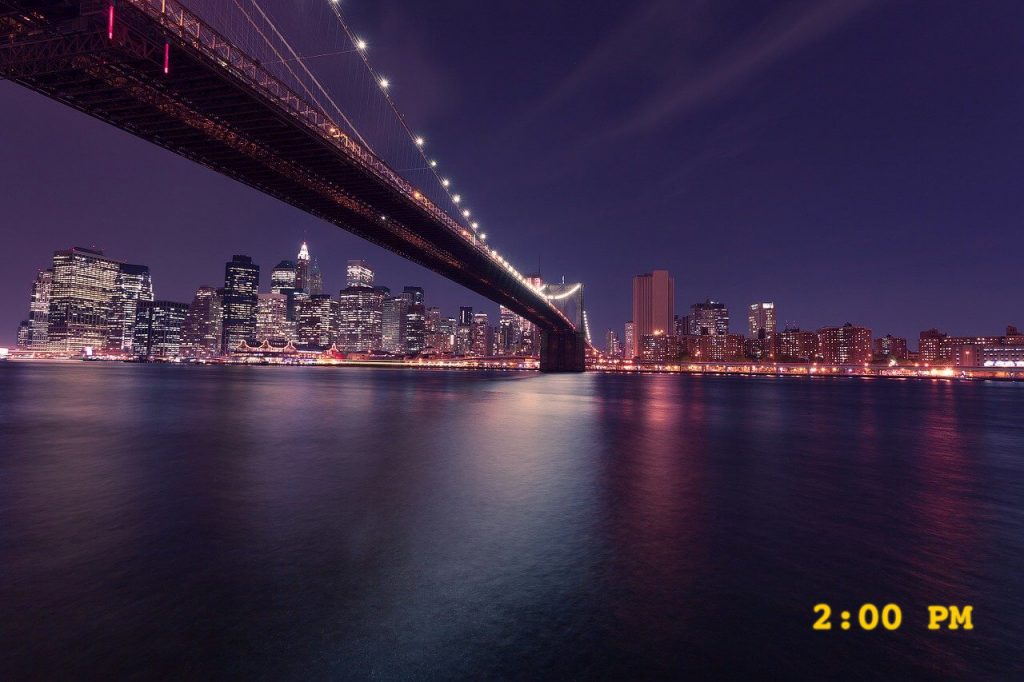
When we refer to time we can say “It’s 2 PM”. This is easy enough to understand. It is early afternoon at our current location.
Digital cameras record date and time in a similar manner. When you load a photo onto your computer, you can see the time as recorded by the camera: 2 PM. The computer, however, cannot make much sense of this information. It is missing an important clue: location or time zone. For all it knows, “2 PM” could mean early afternoon in Hawaii or early afternoon in New York. A 6-hour difference!
What’s more, the camera clock may not actually have the correct time. You could have forgotten to set it as you traveled through time zones. Your photo of the New York night sky could indeed show a “2 PM” camera time.
We thus face two tasks:
- Set the correct time on the photo. E.g. “2 PM Hawaiian time”
- Make that time look “right”. E.g. “8 PM New York time”
Let’s walk through the process.
Continue reading Correct the Date and Time of Photos using HoudahGeo 6.0
HoudahGeo 6.0 Video Tutorial
Todd Olthoff of ScreenCastsOnline takes you on a tour of HoudahGeo 6.
HoudahGeo 6 is an application packed with features to help geocode and add metadata to your photos. With its simple steps of Load, Process, and Output; with all of the features packed in each of these steps HoudahGeo is the application that could start your entire photo workflow and it is the first application that launches when I load my photos to make sure I have all of the metadata embedded in the images themselves so that that data will follow the photo into any photo management application I choose to use.
Todd walks you through the various ways to get photos into HoudahGeo and then covers all of the steps from geocoding, over exporting metadata, to sharing and publishing. Todd does an excellent job describing the many features and finer details. We recommend all HoudahGeo users watch this tutorial.